
Drone Vegetation Analysis
Analysing drone images with machine vision
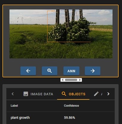
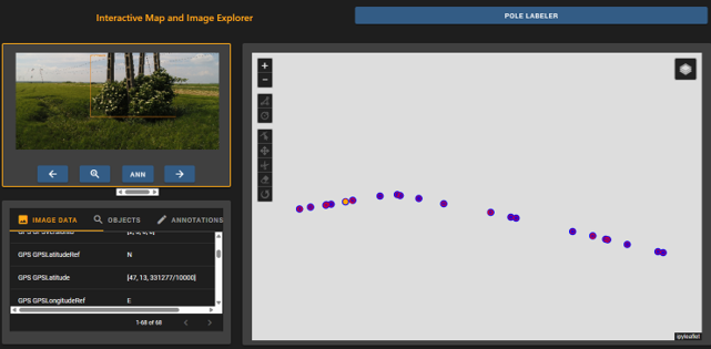
Our website shows how we use drone photos and advanced machine vision technology to automatically analyze the environment around light poles. Our system can accurately identify vegetation at the base of the poles and the plants that are climbing up the poles.
Automatic positioning
Using analyzed images, our system provides accurate location data to help you carry out efficient maintenance and inspection processes.
Lidar data processing
Determining the species or types of vegetation from aerial LiDAR imagery is an automated multi-step process that combines statistical analysis and machine learning algorithms. The main elements of the methodology are:
Data processing phase:
- Point cloud pre-processing
- Rasterization
- Statistical parameter calculation: 55 different indicators are calculated in each cell:
- Height percentiles (e.g. 50%, 95% percentile)
- Canopy relief ratio (CRR)
- Point density and height variance
Technological advantages and limitations
|
Advantage |
Limitations |
|---|---|
|
3D structural data |
Lower resolution in large areas |
|
Automated processing |
Weather-dependent measurement conditions |
|
Spatially continuous data |
Computationally intensive processing |


Simple and accurate LIDAR data analysisProcessing LIDAR data has never been easier! With our advanced technology, we can detect vegetation and electrical distribution network locations from LIDAR images using up to 8-10 different classifications – with accuracy down to centimetres if required.
How does it work?All you have to do is send us your LIDAR data and we will do the processing. We provide you with fast, accurate and reliable results!
Benefits: Extremely accurate measurement and you can immediately see where you need to intervene.
Now at an introductory price
Free DEMO up to 2 km data processing!
Contact us for a free demo.