
Drone Based Electricity Network Inspection

Strategically plan your drone mission with GIS-based insights for comprehensive infrastructure assessment.

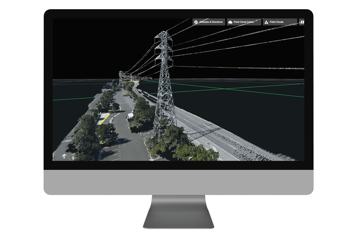
Precisely design your data collection points at an object level for targeted and efficient aerial analysis.
Develop your custom application within your own framework to seamlessly integrate with drone-captured data.
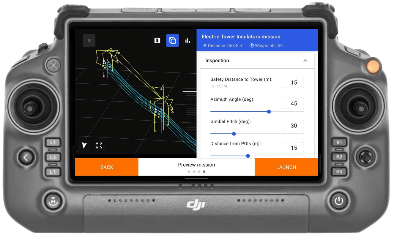
Execute your flight plan meticulously to ensure thorough coverage and high-quality data acquisition.
Integrated Hawk Grid Platform
Work management can be implemented by providing environmental data as part of the corporate system or by importing corporate master data as an independent IT system.
FREE TRIAL WITH YOUR IMAGES
Discover how our customized data science solutions can transform your business. Sign up for our free trial and see firsthand the impact of data-driven decision-making. Send your own images and you can test our system with your own data.
More products
Our other solutions that might be interesting for you.

Car detection
Electrical network inspection from land with car camera detetection. Camera system can be placed for any vehicle.

Satellite
Satellite imagery combined with AI enables you to accurately identify vegetation risks and impacts at any spot, any time.

Railway Systems
The Rail Hawk System can detect the status of objects in the railway track environment and give signals if an object needs to be repaired.