
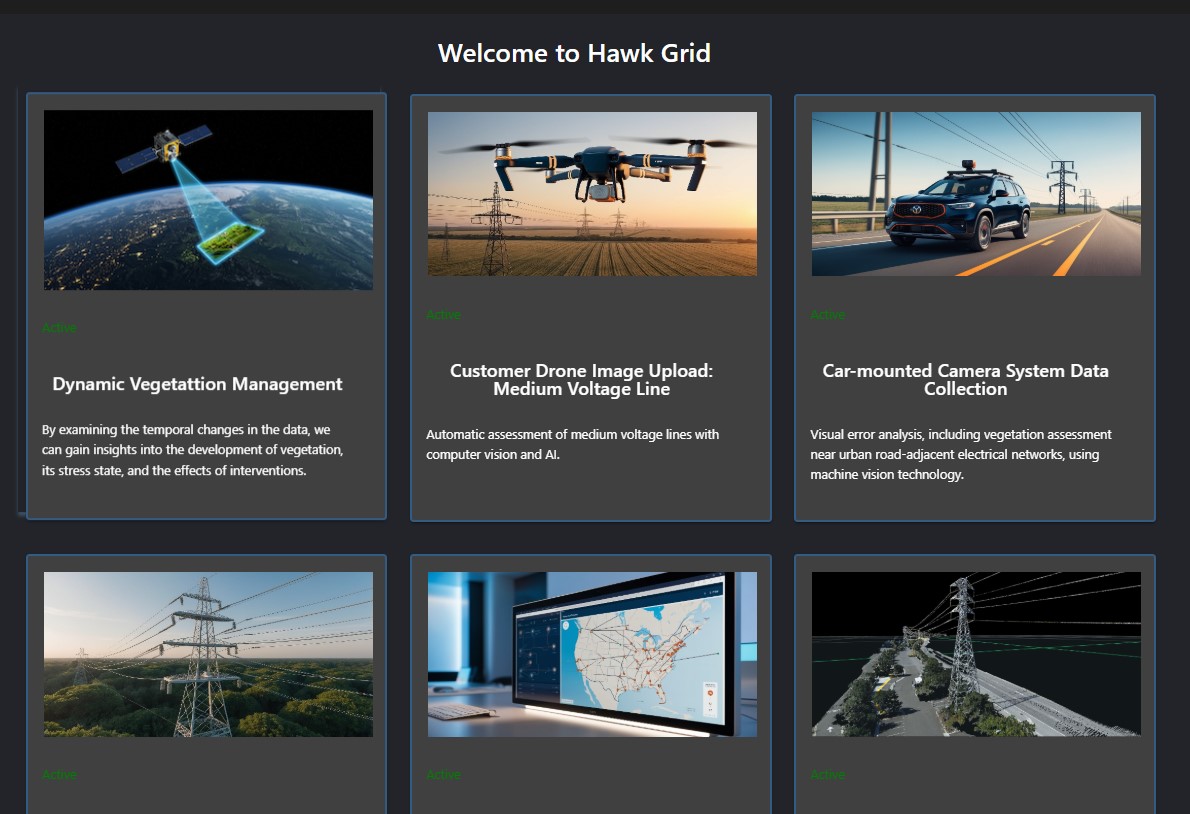
Satellite Vegetation Analysis
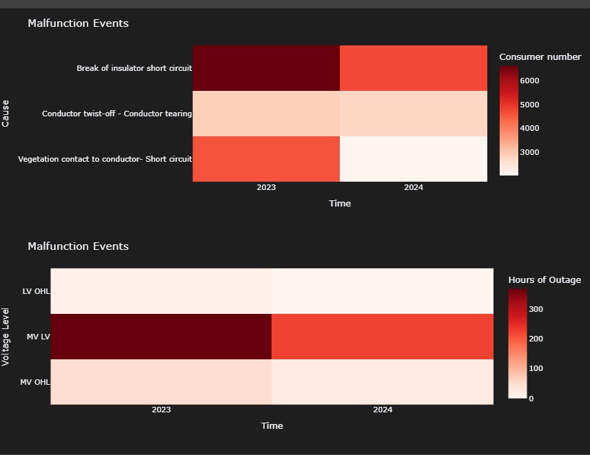
A significant part of the failures in the overhead power line network of power plants can be attributed to the vegetation proliferating along the trails.
The Talamone Group has developed a revolutionary, completely unique technology in the field of satellite vegetation analysis. This innovation breaks with traditional approaches and focuses on real-time, dynamic vegetation analysis.In 2025, we will be the first to introduce the Dynamic Vegetation Management platform for monitoring vegetation in the safety zone of the power grid, offering an unparalleled opportunity to continuously and accurately monitor the state of vegetation.By examining changes in data over time, we can gain insights into vegetation development, stress conditions and the effects of interventions. This helps in the long-term planning and optimisation of horticultural interventions.
The technology is specifically suited to the creation of future vegetation models, allowing more accurate and targeted risk-based interventions to be planned for vegetation management in the safety zones of power grids.
As a first step, we are making our innovative technology available to everyone for free, illustrated with high-resolution satellite images. Register now and try it out with no obligation!
Below, we describe what the analysis includes, what features we use, what the data we retrieve means and how it will benefit your business and technology.
Hawk System demo
After registration in the hawk system DEMO, select the “Dynamic Vegetation” menu.

The Start and End dates are set so that the analysis can be performed in an earlier time dimension. The closing date can be the latest date of the current year/month.
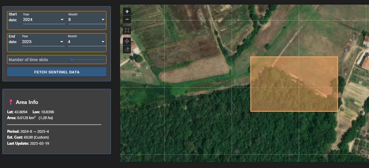
DEMO version demonstrates the system in principle. In the case of a live system, the Network Topology provided by the Customer is recorded in the system and the analysis is run automatically for that area only. Deletion of the selected area can be initiated by clicking on the Finish icon after selecting the selected area.
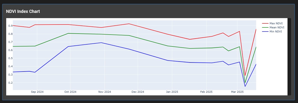
Based on the retrieved data, the system plots the time-series vegetation indexes in real time, taking into account the average data for the selected area.
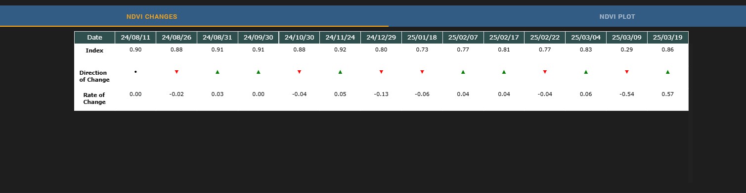
With a time series plot, we can easily compare the changes associated with the base period and their magnitude. This provides a basis for the calculation of future models.
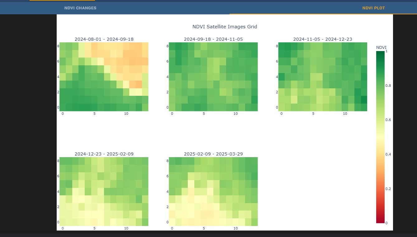
In this view, the vegetation status of the area selected on the map is shown with a clear colour coding. You can clearly see the vegetation changes and the areas where there is no vegetation.
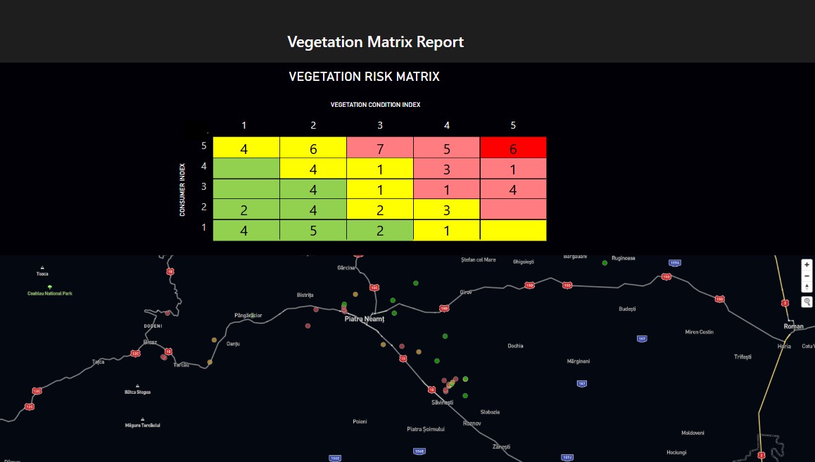
Vegetation risk matrix structure
Probability of risk occurrence:
- Vegetation type (e.g. fast-growing trees vs. network-friendly ornamental trees)
- Type of area (e.g. protected natural area, urban green belt)
- Weather conditions (wind speed, frequency of storms)
The potential impact of proximity to vegetation on electricity networks
- Loss of electricity supply (duration, number of users affected)
- Risk of accidents (e.g. electric shock, fire)
- Environmental damage (e.g. threat to protected bird species)
Complete, up-to-date reporting system.


why choose us?
The Dynamic Vegetation Management platform is a powerful tool as it allows accurate data collection, analysis and planning of targeted interventions. Below we describe how the platform supports this process:
Identify and monitor damaged areas
– The platform uses satellite remote sensing technologies to map large areas that are difficult to reach.
– This is particularly useful for identifying and continuously monitoring areas affected by natural or man-made damage (e.g. forest fires, invasive species, soil erosion) around large-scale infrastructure.
Vegetation indices can be used to accurately determine the regeneration status of vegetation and the effectiveness of interventions.
Data-driven intervention planning
– The platform allows the identification of reference areas to define restoration targets. This ensures that interventions are tailored to the ecological characteristics of the area.
– Time-series data analysis can be used to track ecosystem changes, allowing the precise location of interventions to be identified in time.
Support for targeted interventions
– The platform can be used to identify areas where active interventions are needed and those where natural regeneration is expected.
– Remote sensing data can be used to optimise resources (e.g. labour, materials), making restoration projects more cost-effective
Ensuring long-term sustainability
– The platform will provide a means to assess the success of restoration projects through measurable indicators.
– Data collected on ecosystem recovery processes will help to develop long-term strategies and adapt to climate change.
The Dynamic Vegetation Management platform therefore not only makes the restoration of degraded areas faster and more efficient, but also contributes to their sustainable management